

As-Constructed Surveys
Ozland Survey provides professional as-constructed and as-built surveying services for residential, commercial, civil engineering and infrastructure projects throughout Victoria.
Our surveys capture the actual positions, dimensions and levels of completed construction works, providing reliable survey records for engineering verification, project documentation, asset management and construction handover.
Scope of Survey
Depending on project requirements, our as-constructed surveys may include:
- Road & Pavement Works: Survey of completed road surfaces, pavement edges, road centreline and quarter points, kerbs and channels, footpaths, crossovers and associated road infrastructure.
- Stormwater Drainage Infrastructure: Survey of constructed drainage pits, pipes and connections, including pit cover levels, pipe invert levels, pipe sizes, alignments and accessible drainage details.
- Civil Structures & Concrete Works: Measurement of completed retaining walls, concrete slabs, footings, structural elements and other nominated civil engineering works.
- Building & Construction Elements: Verification of constructed building positions, external wall locations, floor levels, structural grid positions and nominated building components.
- Underground Services & Utilities: Recording the locations, levels and alignments of installed underground services where accessible during construction or before backfilling.
- Earthworks & Finished Surfaces: Survey of completed earthworks, finished ground levels, embankments, batters, pavement surfaces and other constructed terrain features.
- Design Verification: Comparison of measured construction positions and levels against nominated design drawings, dimensions and tolerances where requested.
- Survey Control & Reference Levels: Establishment or use of project control points and benchmarks to provide consistent horizontal and vertical survey information.
Applications
Our as-constructed surveys support road and drainage construction, civil infrastructure upgrades, residential and commercial building projects, subdivision infrastructure works, earthworks verification and completed construction documentation.
They assist engineers, contractors, project managers and local councils in reviewing completed works, identifying differences from design information and preparing reliable project records.
Survey Deliverables
Depending on the scope of work, deliverables may include:
- 2D & 3D AutoCAD drawings (DWG)
- PDF as-constructed survey plans
- Constructed positions and levels
- Drainage pit and pipe invert details
- Road and pavement level information
- Finished surface and contour plans
- 3D survey points and terrain models
- Design comparison information
- MGA / GDA2020 coordinates
- Australian Height Datum (AHD) levels
- Survey control and benchmark details
- Site photographs and supporting records
Construction Verification & Project Handover
As-constructed surveys can be completed progressively during construction or following completion of nominated works, depending on the project requirements.
Where underground infrastructure is involved, survey measurements may be undertaken before backfilling to record information that would otherwise become concealed.
Ozland Survey works with engineers, builders and civil contractors to provide accurate, practical survey documentation that supports construction verification, infrastructure records and project handover.
Examples of Completed Survey Projects
Examples of completed as-constructed survey projects, including verification of road and kerb construction, drainage infrastructure and concrete building slabs against design drawings. Click on an image to view the full drawing.
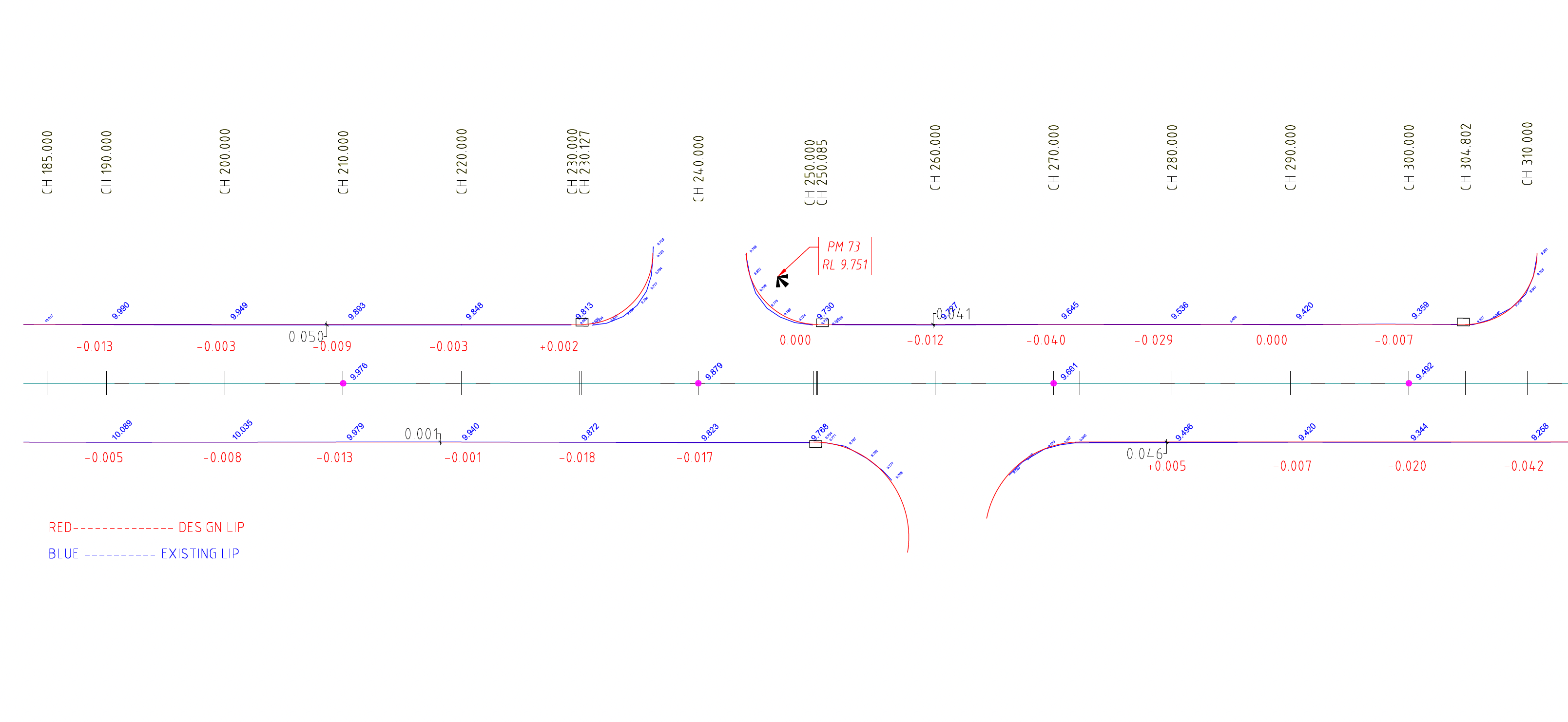
As-Constructed Kerb & Channel Survey
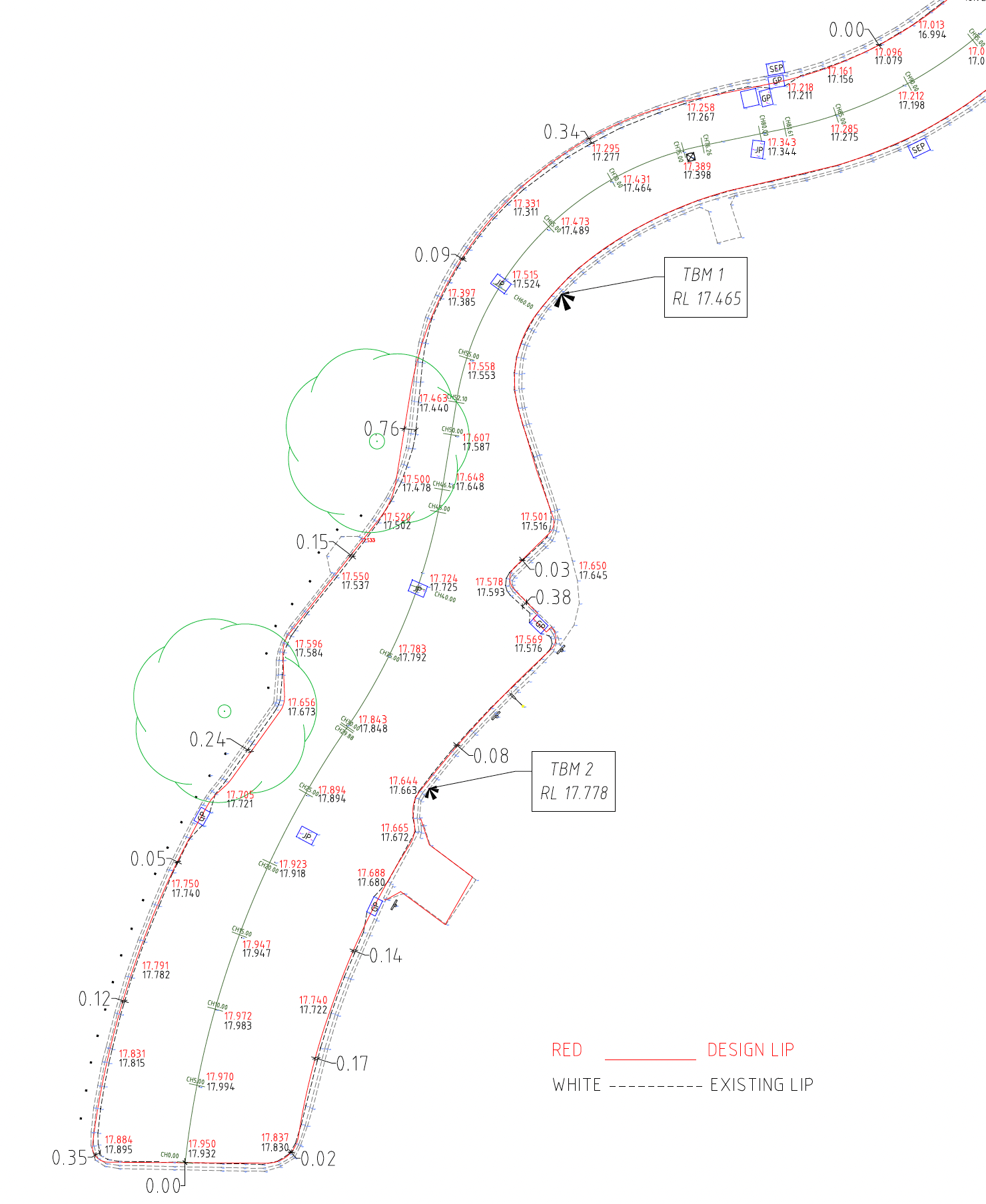
As-Constructed Road, Kerb & Drainage Survey
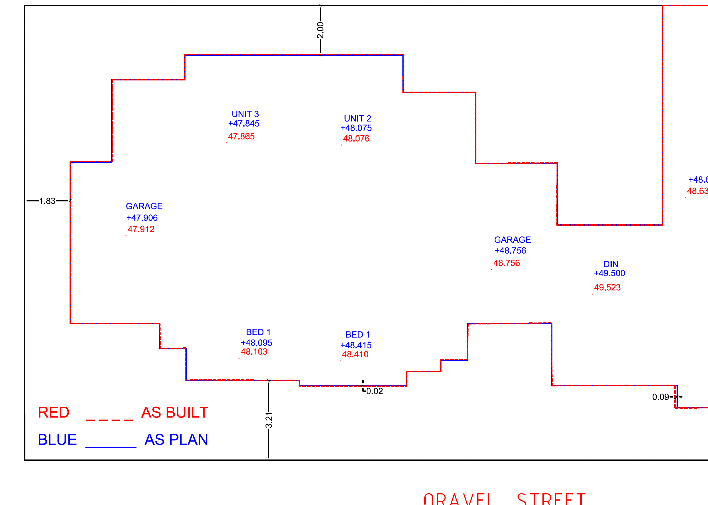
As-Constructed Concrete Slab Survey