

GIS & Geospatial Services
Ozland Survey provides GIS and geospatial data services to support land surveying, civil engineering, infrastructure planning and spatial information management throughout Victoria.
Combining practical surveying experience with geospatial technology, we assist clients in transforming survey measurements and spatial datasets into accurate, structured and useful information for mapping, design and analysis.
Our GIS capabilities complement our surveying services, supporting the integration of field-collected information with existing spatial data and engineering design workflows.
Scope of Services
Depending on project requirements, our GIS and geospatial services may include:
- GIS Mapping & Spatial Data Processing: Preparation, editing and management of digital mapping information, including points, lines, polygons, attributes and spatial datasets.
- CAD & GIS Integration: Conversion and integration of spatial information between AutoCAD drawings, GIS platforms and commonly used geospatial file formats.
- Coordinate Systems & Transformations: Management of survey coordinates, map projections and spatial reference systems, including MGA / GDA2020 and other specified project coordinate systems.
- Digital Terrain Modelling: Processing of three-dimensional survey data to develop Triangulated Irregular Networks (TIN), Digital Terrain Models (DTM), contours and ground surface representations.
- Topographical & Elevation Data: Preparation and processing of spot levels, elevation datasets, terrain surfaces and related information for engineering and planning applications.
- Infrastructure & Asset Mapping: Organisation and mapping of surveyed infrastructure features, including roads, drainage assets, service locations and other relevant spatial information.
- Spatial Data Analysis: Examination and interpretation of geographic relationships, site features, terrain characteristics and infrastructure information to support technical investigations.
- Geospatial Data Preparation: Cleaning, formatting and structuring of spatial information for use in GIS software, CAD environments and engineering design systems.
Applications
Our GIS and geospatial services support civil engineering design, infrastructure planning, land development, asset mapping, terrain analysis, environmental investigations and the integration of survey information with existing spatial datasets.
We assist engineers, designers, local councils and other professionals who require practical, reliable and compatible spatial information for their projects.
Survey & Geospatial Deliverables
Depending on the scope of work, deliverables may include:
- GIS maps and spatial datasets
- 2D & 3D AutoCAD drawings (DWG)
- Shapefiles and GeoPackage files
- Georeferenced spatial information
- Digital Terrain Models (DTM)
- Triangulated Irregular Networks (TIN)
- Contour and elevation datasets
- Spatial data layers and attributes
- MGA / GDA2020 coordinate data
- PDF maps and technical drawings
- CAD and GIS data conversions
- Supporting spatial data files
Surveying & Geospatial Integration
Our combined surveying and geospatial capabilities allow field-collected measurements to be processed and incorporated into digital mapping, terrain modelling and engineering design workflows.
We focus on producing accurate, organised and fit-for-purpose spatial information that can be readily used by project teams across different software platforms.
Whether working with newly collected survey data or existing spatial datasets, Ozland Survey provides practical geospatial support to complement professional land surveying and engineering projects.
GIS & Geospatial Technical Projects
Selected academic and technical work demonstrating GIS mapping, spatial analysis, georeferencing, environmental data visualisation and AI-assisted infrastructure feature detection. Click on an image to view the full project illustration.
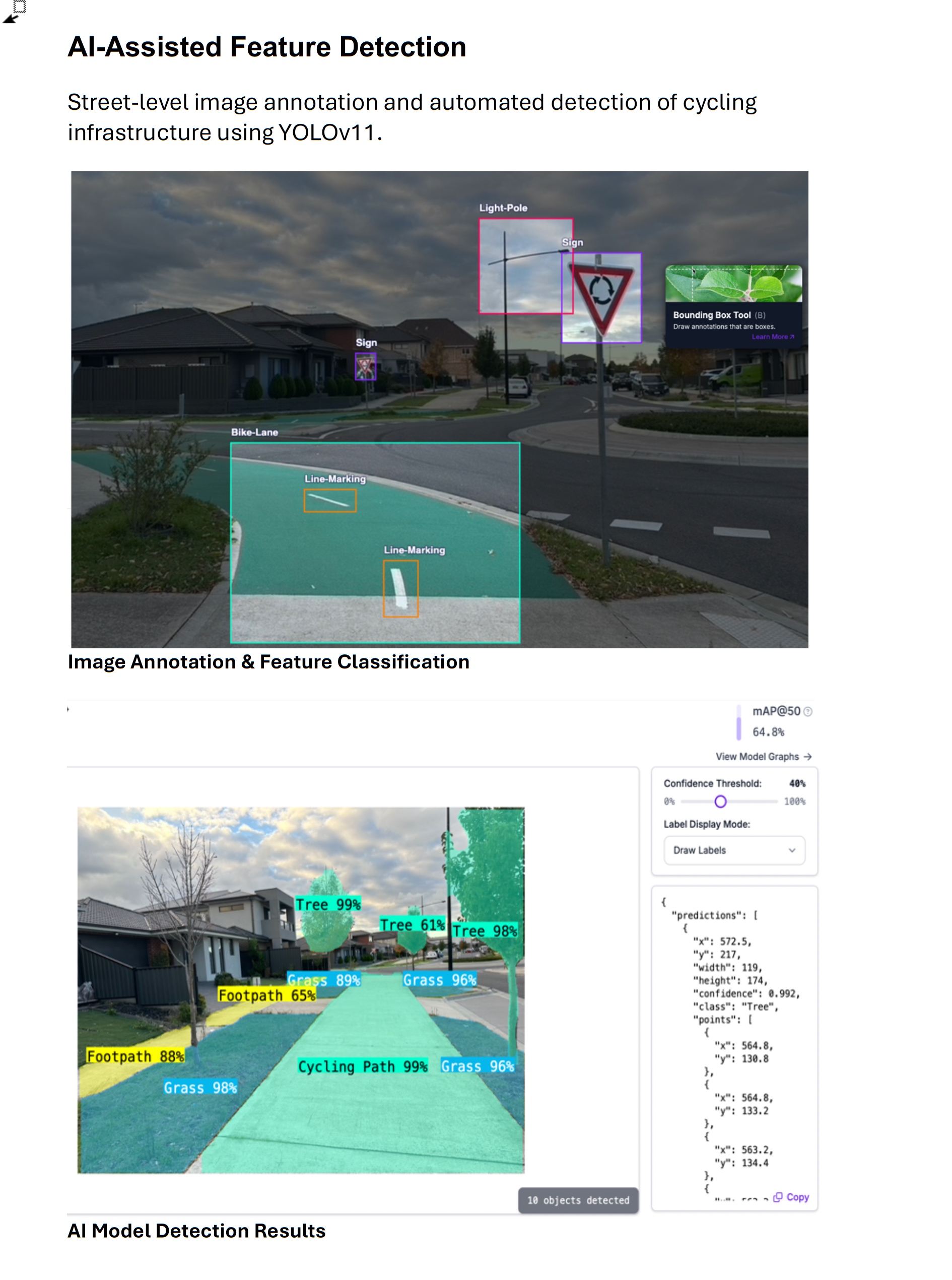
AI-Assisted Feature Detection
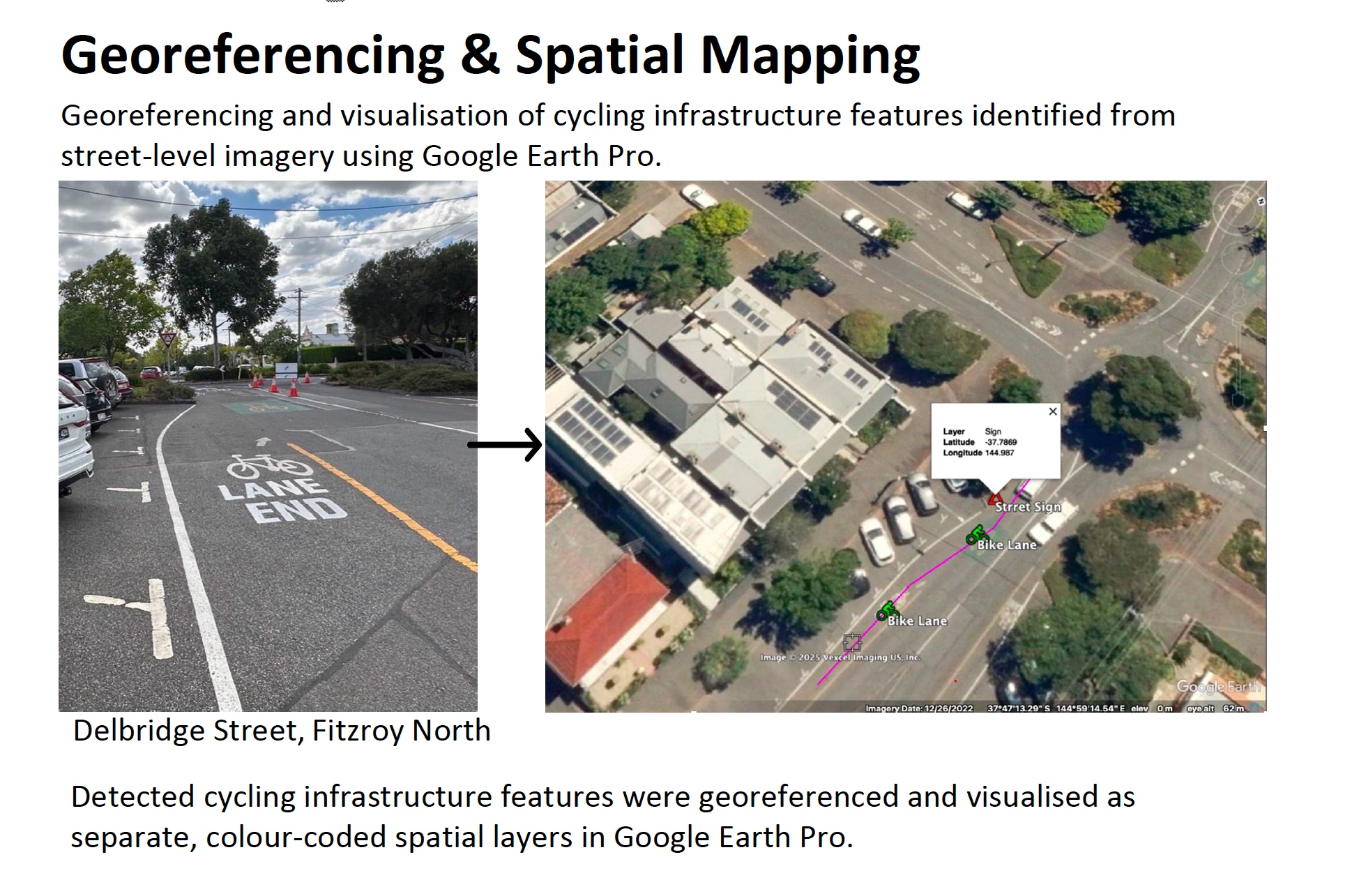
Georeferencing & Spatial Mapping
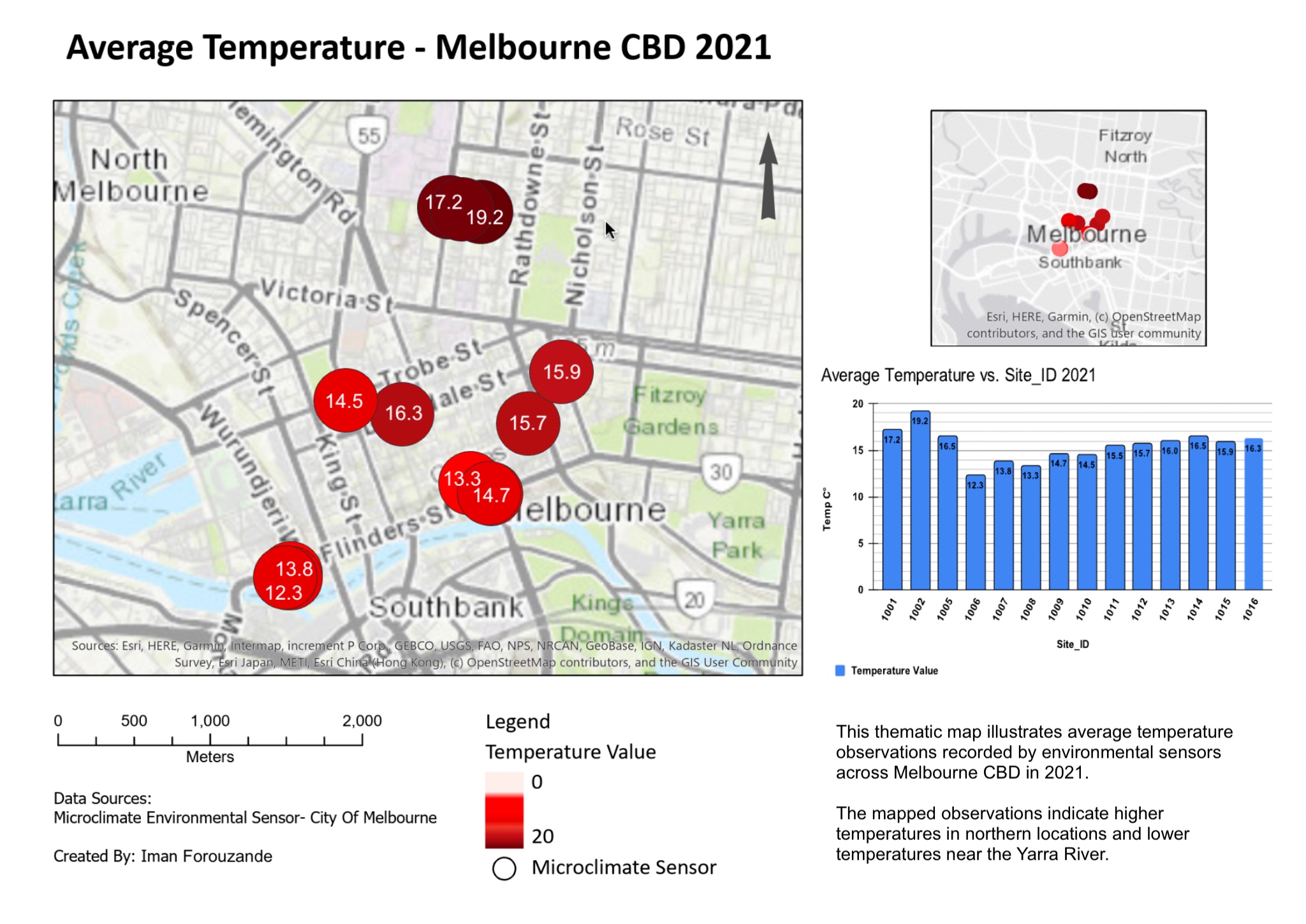
GIS Thematic Mapping & Data Visualisation
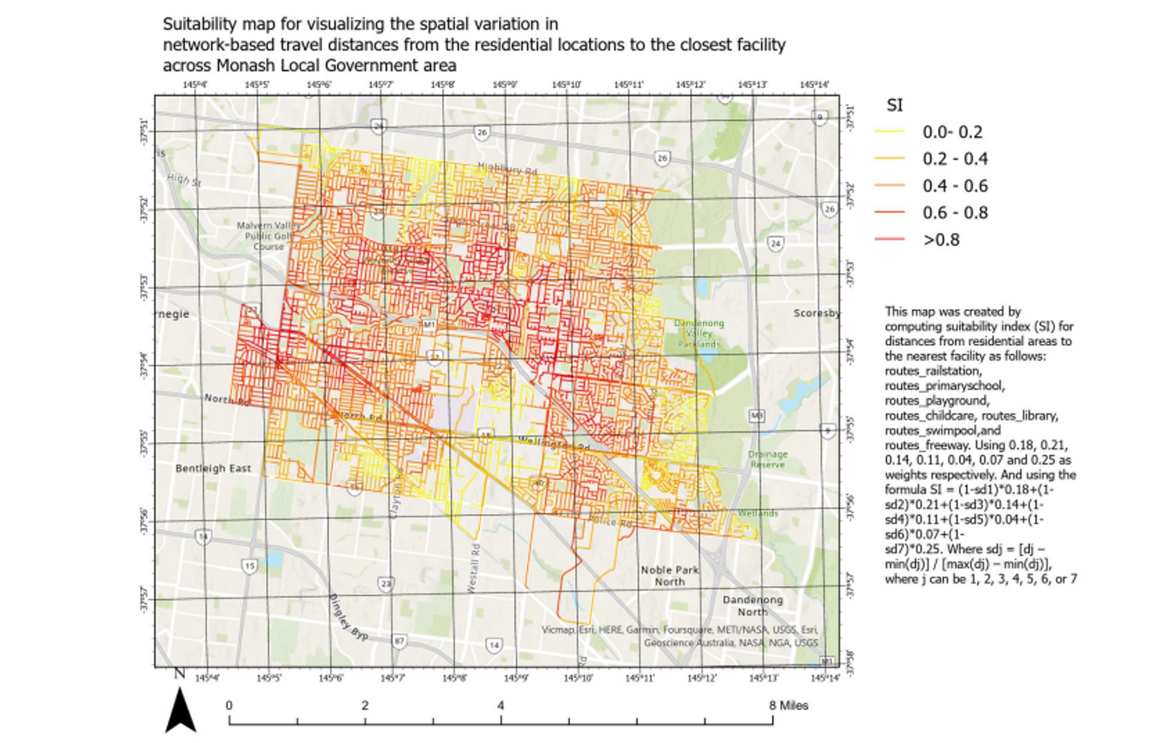
Network-Based Suitability Analysis