

Feature & Level Surveys
Ozland Survey provides comprehensive 2D and 3D feature and level surveys for residential, commercial, civil engineering and infrastructure projects throughout Victoria.
Our surveys capture detailed information about existing site conditions, natural and constructed features, surface levels and relevant infrastructure. Each survey is tailored to the technical requirements of the project, providing reliable information for planning, engineering design and construction.
Scope of Survey
Depending on project requirements, our feature and level surveys may include:
- Site Features: Existing buildings, structures, driveways, pavements, retaining walls, fences, sheds, garages, pools and other relevant site improvements.
- Levels & Topography: Spot levels, contours, changes in ground level, surface features and digital terrain information.
- Road & Street Features: Kerbs and channels, footpaths, crossovers, pram crossings, road surfaces, signs, poles, trees, drainage pits and other road infrastructure.
- Buildings & Adjoining Properties: Building footprints, setbacks, floor levels, roof ridges, eaves, gutters, windows, fences and relevant adjoining structures, including information required for planning assessments.
- Vegetation: Location of significant trees and vegetation, including approximate heights and relevant details where required.
- Drainage & Services: Location and levels of accessible drainage pits, pipe invert levels and visible service infrastructure, with additional underground service information where available or specifically included.
- Survey Control: Establishment of Temporary Bench Marks (TBMs), with horizontal coordinates and vertical levels referenced to the applicable project datum.
Applications
Our feature and level surveys support a wide range of projects, including residential and commercial developments, architectural and town planning applications, road and infrastructure design, drainage engineering, site redevelopment and construction planning.
Surveys can also incorporate adjoining properties, road reserves, easements and defined survey corridors where required.
Survey Deliverables
Depending on the scope of work, Ozland Survey can provide:
- 2D and 3D AutoCAD drawings (DWG)
- PDF survey plans
- Spot levels and contour plans
- Triangulated Irregular Networks (TIN)
- Digital Terrain Models (DTM) and surface data
- Survey coordinates referenced to MGA / GDA2020 where specified
- Levels referenced to the Australian Height Datum (AHD)
- Temporary Bench Mark information
- Site photographs and supporting survey information
Site Access & Project Coordination
Where surveys require access to adjoining properties, drainage easements or privately located infrastructure, Ozland Survey can assist with coordinating access arrangements, including property-owner correspondence and site appointments.
Our objective is to deliver accurate, practical and fit-for-purpose survey information that supports the next stage of each project.
Examples of Completed Survey Projects
Examples of feature and level survey drawings prepared by Ozland Survey, including road infrastructure, civil engineering and residential projects. Click on an image to view the full drawing.
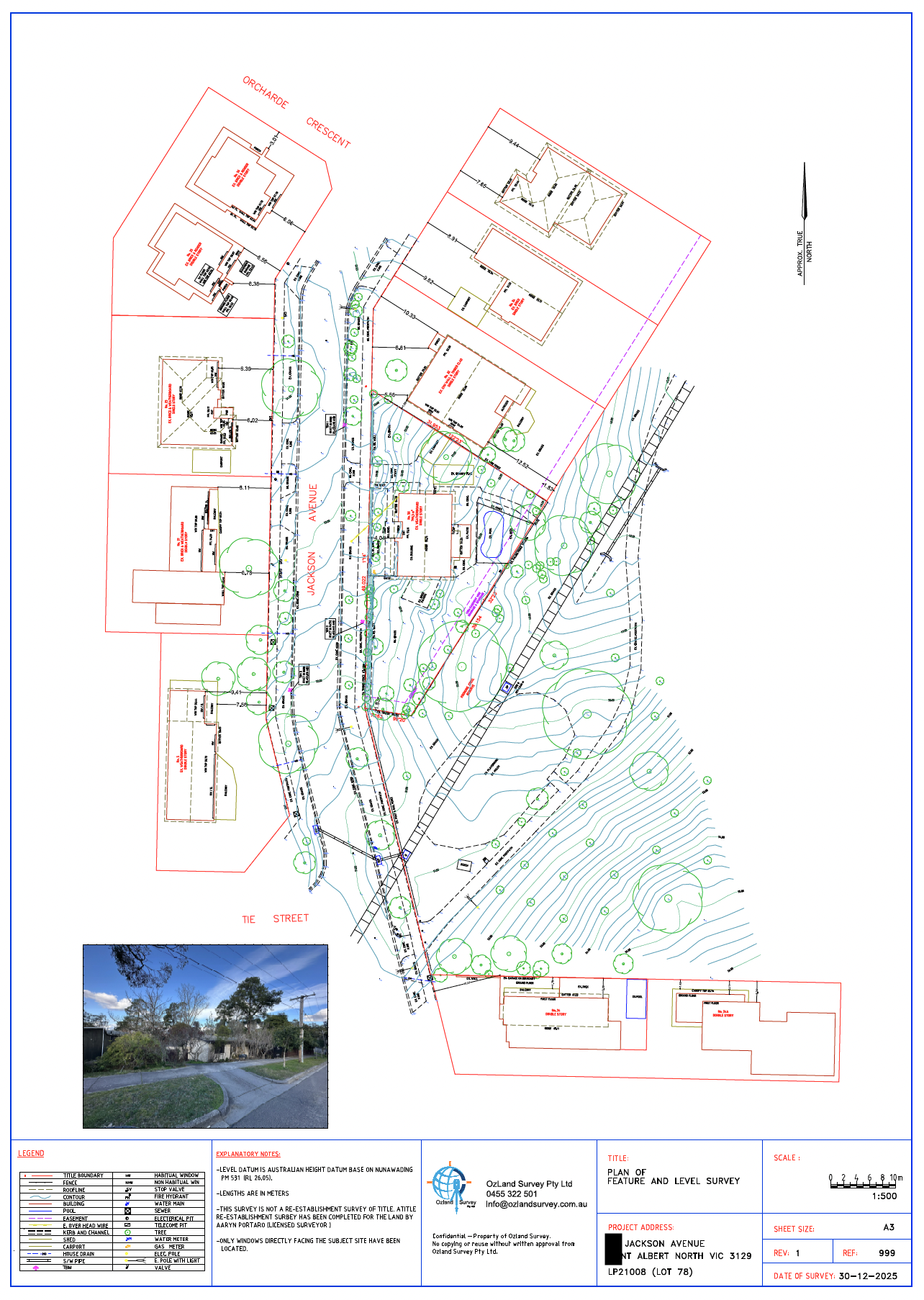
Residential Feature & Level Survey
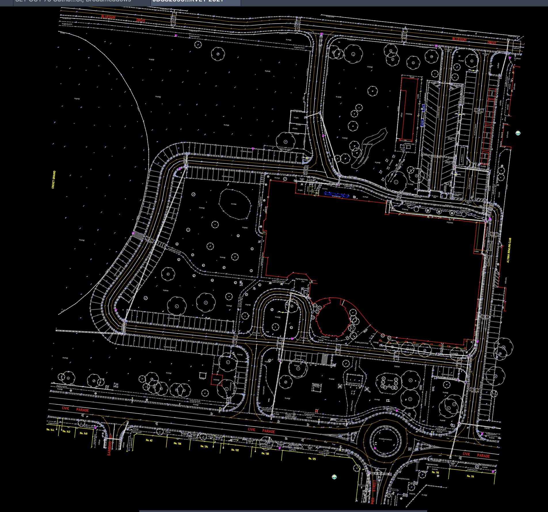
Civil Infrastructure & Site Feature Survey
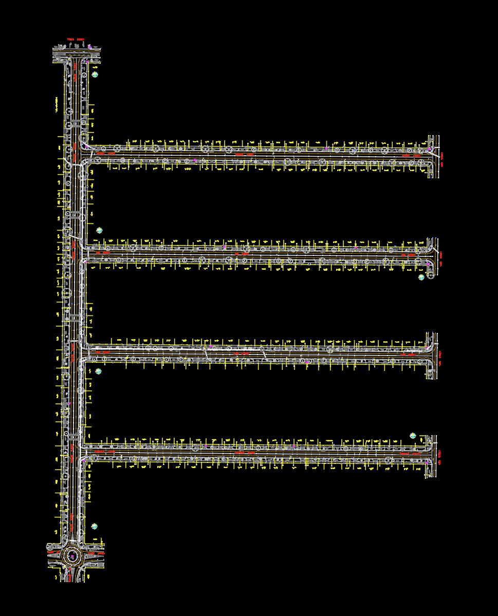
Road Network Feature Survey
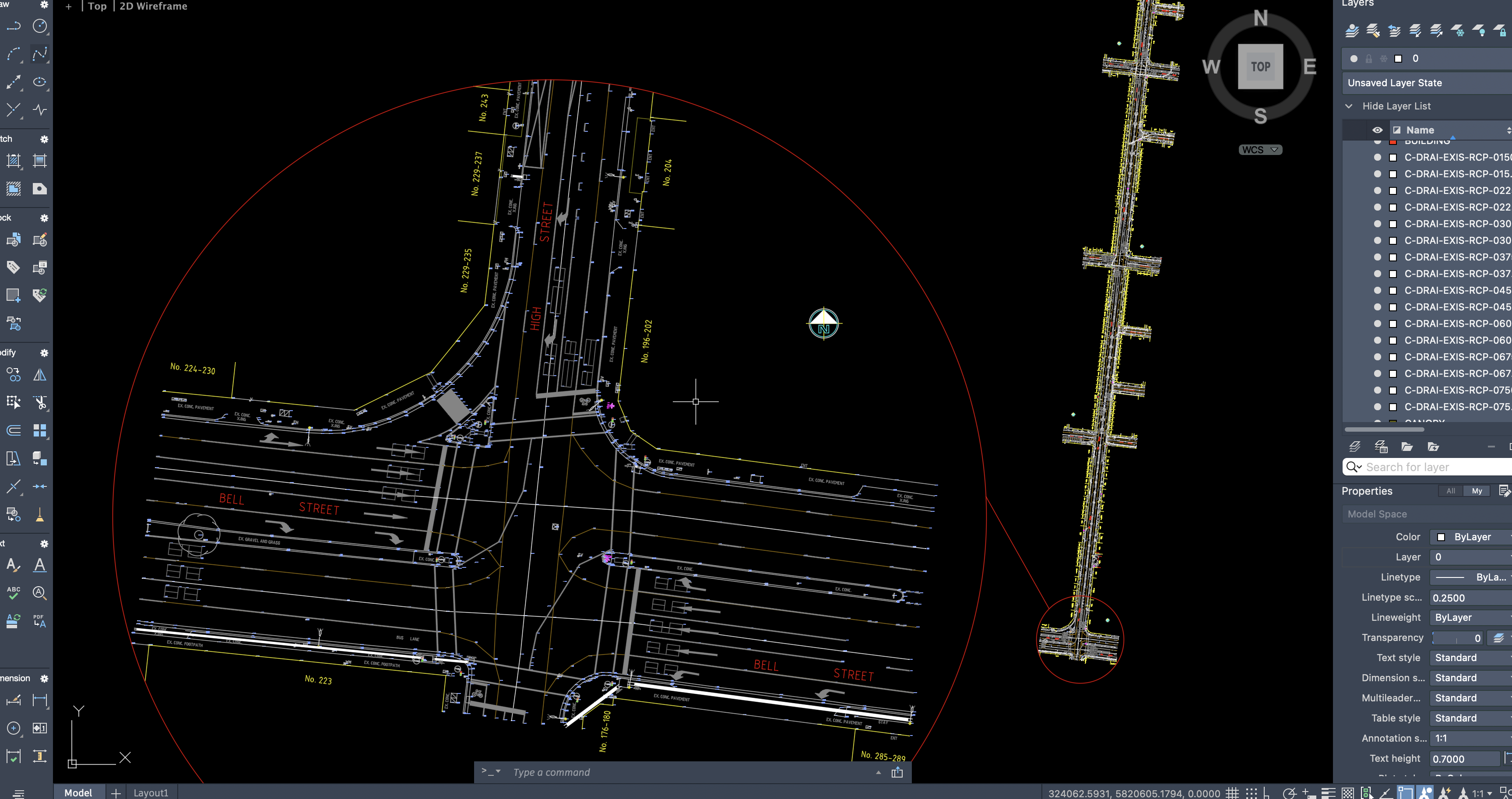
Road Intersection Survey - AutoCAD View
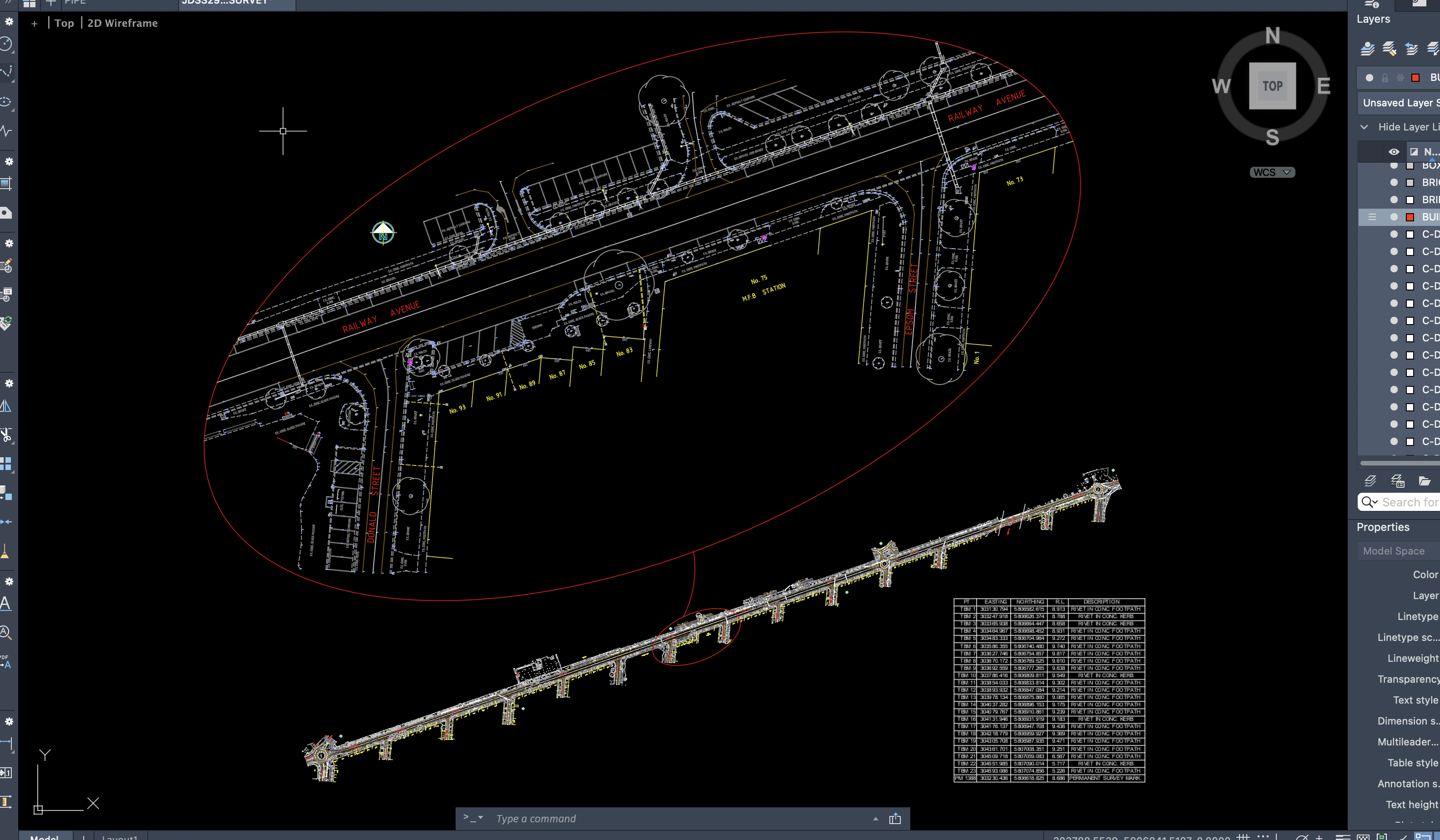
Road Corridor Survey - AutoCAD View
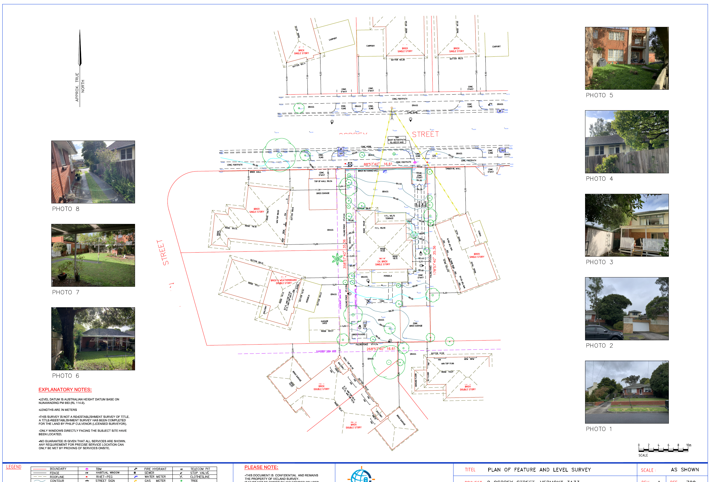
Residential Feature Survey & Site Photography